Skip to content
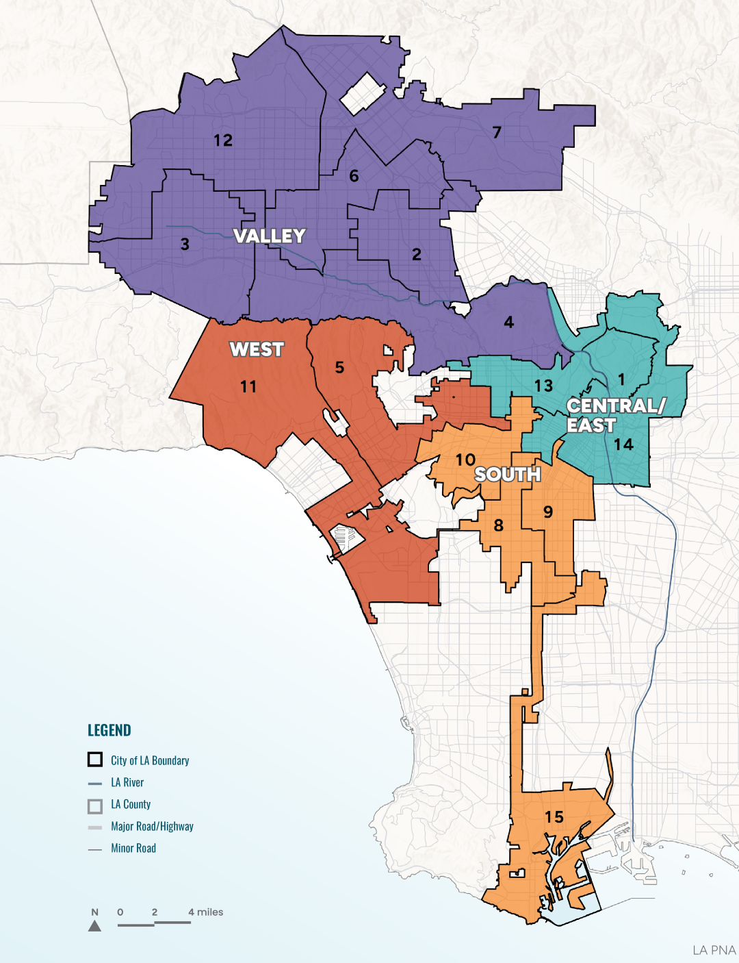
To provide a more nuanced analysis of park needs grounded in the lived realities of Angelenos, the PNA divides the City into four geographic regions: East/Central, South, West, and the Valley.

This framework acknowledges that there are different needs and pressures in each region, from disparities in park access and recreational resources to differences in community priorities.

By incorporating a view of the distinct issues and opportunities in each region, the PNA can help RAP tailor its actions to the needs in different parts of the City. Chapter 9 provides a more detailed overview of each region, including survey results, demographic snapshots, and feedback from residents.

Regions
City Boundary and Parks: City of LA Data Portal, 2025. Roads: US Census Bureau, 2025., LA River: National Hydrography Database, 2025.

Valley

Characterized by historic suburban, low-density development and vast landscapes, the Valley includes some of RAP’s largest and most popular recreation areas and faces challenges around access and interconnectivity.

Council Districts 2, 3, 4, 6, 7, 12
Learn More

South

Encompassing one of the City’s most historically significant and culturally rich communities, the South region’s historic disinvestment underlies challenges with safety, underfunded programming and staffing, and environmental burdens.

Council Districts 8, 9, 10, 15
Learn More

West

Known for its coastal proximity and lower density, the West region’s diverse range of park and recreation facilities, from beaches to mountain trails, face increased wildfire risk as well as overall challenges of maintenance and safety.

Council Districts 5, 11
Learn More

East/Central

Home to some of the most diverse and densest neighborhoods in the City, the East/Central region faces challenges of high park pressure, low park acreage, and displacement and green gentrification.

Council Districts 1, 13, 14
Learn More
Download the Draft PNA PDF
Sign Up for Project Updates

Translate This Site
Follow Us
Back To Top